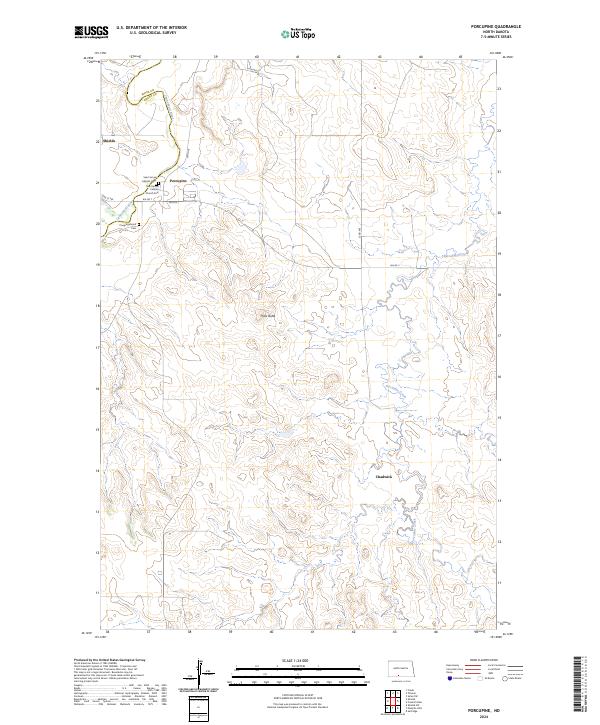
2024 Map of Porcupine
USGS Topo · Published 2024About this map
The Cannonball River carves a winding path through the northwest corner of this landscape, marking the boundary between Sioux and Grant Counties. The settlement of Porcupine serves as a central hub, anchored by the Saint James Catholic Church and its associated burial grounds, Saint James Catholic Cem and Saint James Catholic Church Cem. These features, alongside the Congregational Cem further south, provide significant touchstones for genealogical research in this rural North Dakota region.
Find a feature on this map
20 named features on this map. Tap any name to fly to it.
Don’t see what you’re looking for? This feature index may not catch every label — zoom into the map to look around manually.
Map Details
Editions of this 2024 Porcupine Map
This is the sole edition of this map. No revisions or reprints were ever made.
Other maps of this area

1954 · Bismarck
USGS Topo · 1:250,000

1958 · Bismarck
USGS Topo · 1:250,000

1971 · Shields SW
USGS Topo · 1:24,000

1971 · Froelich Dam
USGS Topo · 1:24,000

1971 · Shields
USGS Topo · 1:24,000

1971 · Solen SW
USGS Topo · 1:24,000

1971 · Porcupine
USGS Topo · 1:24,000

1971 · Timmer
USGS Topo · 1:24,000

1971 · Selfridge
USGS Topo · 1:24,000

1971 · Pamplin Hills
USGS Topo · 1:24,000