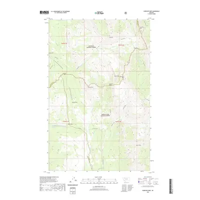
2020 Map of Porphyry Reef
USGS Topo · Published 2020About this map
Flathead National Forest and Lewis & Clark National Forest meet along a complex high-altitude boundary defined by the crests of the Sawtooth Range. The Continental Divide National Scenic Trail winds through this wilderness, traversing critical transitions at Sun River Pass and skirting the edge of Porphyry Reef. The terrain is characterized by dramatic ridges like Washboard Reef and Wapiti Ridge, which channel drainage into the N Fork Sun River and the W Fork Teton. Small alpine openings such as McDonald Park and Round Park offer breaks in the dense forest cover near McDonald Cr. This survey illustrates the intricate intersection of Flathead, Teton, and Lewis and Clark counties, where the hydrological divide dictates both the political boundaries and the primary routes of passage, such as the Monroe Cr Cutoff.
Find a feature on this map
42 named features on this map. Tap any name to fly to it.
Don’t see what you’re looking for? This feature index may not catch every label — zoom into the map to look around manually.
Map Details
Editions of this 2020 Porphyry Reef Map
This is the sole edition of this map. No revisions or reprints were ever made.
Other maps of this area

1903 · Saypo
USGS Topo · 1:125,000

1913 · Marias Pass
USGS Topo · 1:125,000

1914 · Heart Butte
USGS Topo · 1:125,000

1918 · Heart Butte
USGS Topo · 1:125,000

1936 · Silvertip
USGS Topo · 1:96,000

1942 · Silvertip
USGS Topo · 1:125,000

1955 · Choteau
USGS Topo · 1:250,000

1957 · Choteau
USGS Topo · 1:250,000

1958 · Choteau
USGS Topo · 1:250,000

1958 · Porphyry Reef
USGS Topo · 1:24,000