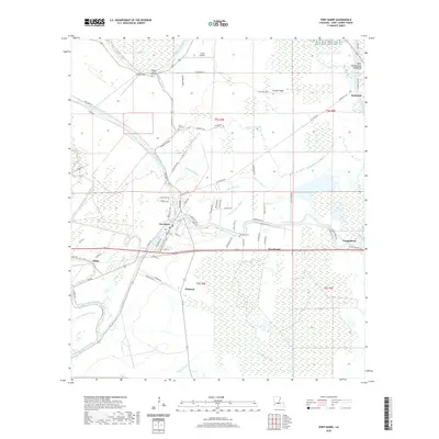
2020 Map of Port Barre
USGS Topo · Published 2020About this map
Port Barre sits at the nexus of a complex hydrological network in St. Landry Parish, where the waters of Bayou Courtableau and Bayou Teche converge. This 2020 landscape is defined by its low-lying basin, characterized by numerous sloughs such as DeJean Slough and Noel Slough, and the managed drainage of the West Atchafalaya Floodway to the east. The map detail reflects a deeply rooted Cajun and Creole cultural landscape, evidenced by the density of family-named cemeteries and small settlements including Chiasson, Hazelwood, and Courtableau.
Find a feature on this map
82 named features on this map. Tap any name to fly to it.
Don’t see what you’re looking for? This feature index may not catch every label — zoom into the map to look around manually.
Map Details
Editions of this 2020 Port Barre Map
This is the sole edition of this map. No revisions or reprints were ever made.
Other maps of this area
1939 · Opelousas
USGS Topo · 1:62,500
1940 · Arnaudville
USGS Topo · 1:62,500

1952 · Lake Charles
USGS Topo · 1:250,000

1954 · Lake Charles
USGS Topo · 1:250,000

1954 · Baton Rouge
USGS Topo · 1:250,000
1956 · Opelousas
USGS Topo · 1:62,500
1956 · Baton Rouge
USGS Topo · 1:250,000
1957 · Opelousas
USGS Topo · 1:62,500
1957 · Carencro
USGS Topo · 1:62,500
1959 · Palmetto
USGS Topo · 1:62,500