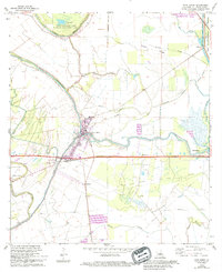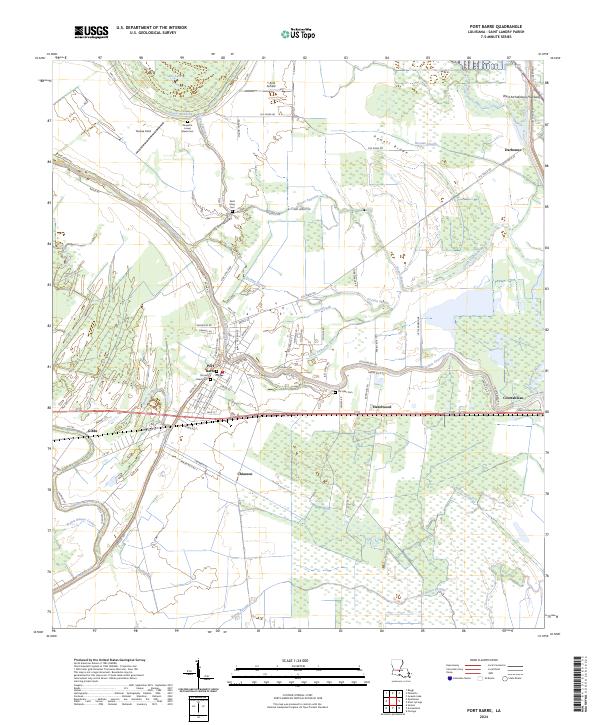
2024 Map of Port Barre
USGS Topo · Published 2024About this map
Port Barre serves as the focal point of this St. Landry Parish survey, where the convergence of Bayou Courtableau and Bayou Teche defines the local geography. The landscape is a network of waterways and drainage features, including DeJean Slough, Noel Slough, and Little Darbonne Bayou. This modern map details the settlement patterns of established communities like Hazelwood, Chiasson, and Darbonne, alongside industrial and agricultural landmarks such as Yankee Field and the T & M Airfield.
Find a feature on this map
86 named features on this map. Tap any name to fly to it.
Don’t see what you’re looking for? This feature index may not catch every label — zoom into the map to look around manually.
Map Details
Editions of this 2024 Port Barre Map
This is the sole edition of this map. No revisions or reprints were ever made.