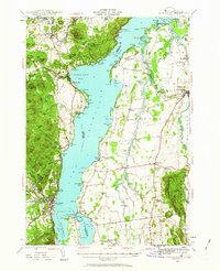
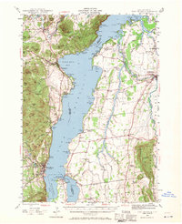
1945 Map of Port Henry
USGS Topo · Published 1963About this map
Lake Champlain serves as the focal point of this 1945 survey, dividing the shoreline of New York and Vermont. The landscape is defined by the historic military sites at Crown Point, where the Fort St Frederic Ruins and Fort Crown Point Ruins stand as reminders of colonial-era fortifications. These landmarks are connected across the narrows to Vermont by the Lake Champlain Bridge. To the west, the New York side features the steep elevations of Split Rock Mountain and the settlement of Port Henry, while the eastern Vermont shore is characterized by fertile lowlands and meandering waterways like Otter Creek and Dead Creek.
Find a feature on this map
146 named features on this map. Tap any name to fly to it.
Don’t see what you’re looking for? This feature index may not catch every label — zoom into the map to look around manually.
Map Details
Editions of this 1945 Port Henry Map
5 editions found
Other maps of this area

1894 · Elizabethtown
USGS Topo · 1:62,500

1894 · Port Henry
USGS Topo · 1:62,500

1894 · Ticonderoga
USGS Topo · 1:62,500

1895 · Willsboro
USGS Topo · 1:62,500

1895 · Elizabethtown
USGS Topo · 1:62,500

1895 · Ausable
USGS Topo · 1:62,500

1895 · Paradox Lake
USGS Topo · 1:62,500

1896 · Ticonderoga
USGS Topo · 1:62,500

1897 · Paradox Lake
USGS Topo · 1:62,500

1898 · Port Henry
USGS Topo · 1:62,500