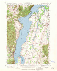
1945 Map of Port Henry
USGS Topo · Published 1971About this map
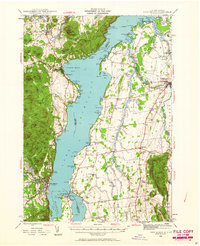
Lake Champlain serves as the central artery for this mid-century survey, dividing the lakeside villages and mountainous terrain of New York from the rolling farmlands of Vermont. The landscape around Port Henry and Westport is marked by the industrial and military history of the region, visible in the Delaware and Hudson railroad line and the prominent Fort St Frederic Ruins at the tip of Crown Point. On the Vermont shore, a dense network of country schools like Potash Sch and West Panton Sch reflects a settled agricultural community in Addison Co. The terrain is characterized by numerous bays and points, such as North West Bay and Basin Harbor, which supported recreational landmarks like Camp Dudley and the Ecole Champlain. The inclusion of Furnace Pt and Ore Bed Pt hints at the area's earlier mining and smelting activities that once utilized the lake for transport.
Find a feature on this map
161 named features on this map. Tap any name to fly to it.
Don’t see what you’re looking for? This feature index may not catch every label — zoom into the map to look around manually.
Map Details
Editions of this 1945 Port Henry Map
5 editions found
Other maps of this area

1894 · Elizabethtown
USGS Topo · 1:62,500

1894 · Port Henry
USGS Topo · 1:62,500

1894 · Ticonderoga
USGS Topo · 1:62,500

1895 · Willsboro
USGS Topo · 1:62,500

1895 · Elizabethtown
USGS Topo · 1:62,500

1895 · Ausable
USGS Topo · 1:62,500

1895 · Paradox Lake
USGS Topo · 1:62,500

1896 · Ticonderoga
USGS Topo · 1:62,500

1897 · Paradox Lake
USGS Topo · 1:62,500

1898 · Port Henry
USGS Topo · 1:62,500