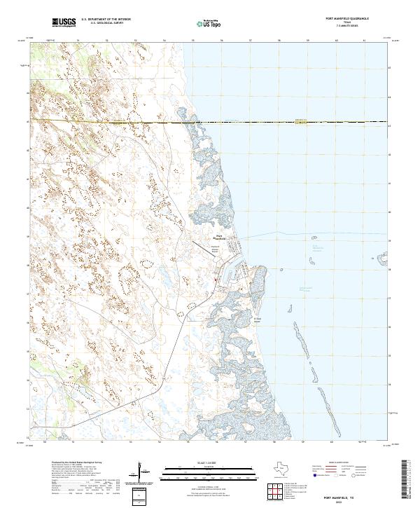
2022 Map of Port Mansfield
USGS Topo · Published 2022About this map
Port Mansfield stands as a focal point along the South Texas coast, where the man-made Port Mansfield Channel provides critical access through the barrier islands to the Gulf of Mexico. This coastal environment is defined by the expansive, shallow waters of Red Fish Bay and the protected path of the Intracoastal Waterway, which facilitates regional maritime transit. The layout of the settlement is deeply tied to its nautical orientation, with residential streets like Baffin Dr and Matagorda Dr leading toward the harbors and piers.
Find a feature on this map
20 named features on this map. Tap any name to fly to it.
Don’t see what you’re looking for? This feature index may not catch every label — zoom into the map to look around manually.
Map Details
Editions of this 2022 Port Mansfield Map
This is the sole edition of this map. No revisions or reprints were ever made.
Other maps of this area

1921 · Tarida Ranch
USGS Topo · 1:62,500

1951 · South of Potrero Lopeno NE
USGS Topo · 1:24,000

1952 · Green Island
USGS Topo · 1:24,000

1952 · South of Potrero Lopeno NW
USGS Topo · 1:24,000

1952 · South of Potrero Lopeno SE
USGS Topo · 1:24,000

1952 · Hawk Island
USGS Topo · 1:24,000

1952 · Port Mansfield
USGS Topo · 1:24,000

1952 · South of Potrero Lopeno
USGS Topo · 1:62,500

1953 · Brownsville
USGS Topo · 1:250,000
1955 · La Leona
USGS Topo · 1:62,500