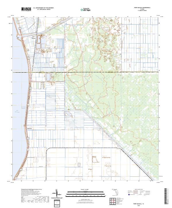
2024 Map of Port Mayaca
USGS Topo · Published 2024About this map
Port Mayaca serves as a critical junction where the Saint Lucie Canal meets the vast waters of Lake Okeechobee. This modern topographic survey illustrates the intersection of south Florida's massive water management infrastructure and preserved natural spaces. The landscape is defined by the Okeechobee Waterway and the L-8 Canal, which segment the terrain into highly engineered agricultural and conservation blocks. East of the lake, an extensive network of recreational paths including the Florida National Scenic Trl and various loops of the Dupuis Reserve Trl wind through the interior, reflecting a transition from the commercial water routes to protected wetlands. Local roads like Morning Star Farms Rd and Hole In The Wall Rd provide access to the rural interiors of Martin and Palm Beach Counties, while the feature known as Sand Cut marks a distinct point along the lake’s eastern shoreline.
Find a feature on this map
24 named features on this map. Tap any name to fly to it.
Don’t see what you’re looking for? This feature index may not catch every label — zoom into the map to look around manually.
Map Details
Editions of this 2024 Port Mayaca Map
This is the sole edition of this map. No revisions or reprints were ever made.
Other maps of this area

1953 · Okeechobee 4 SW
USGS Topo · 1:24,000

1953 · Okeechobee 4 SE
USGS Topo · 1:24,000

1953 · Indian Town
USGS Topo · 1:24,000

1956 · West Palm Beach
USGS Topo · 1:250,000

1956 · Fort Pierce
USGS Topo · 1:250,000

1957 · West Palm Beach
USGS Topo · 1:250,000

1958 · Fort Pierce
USGS Topo · 1:250,000

1958 · West Palm Beach
USGS Topo · 1:250,000

1959 · Fort Pierce
USGS Topo · 1:250,000

1970 · West Palm Beach 2 SW
USGS Topo · 1:24,000