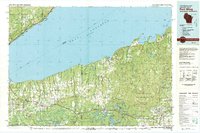
1980 Map of Port Wing
USGS Topo · Published 1980About this map
The south shore of Lake Superior dominates this 1980 survey, illustrating a landscape defined by extensive public lands and small lakeshore settlements. The topography transition from the expansive Chequamegon National Forest and Brule River State Forest to the rugged coastline includes prominent features like Roman Point and the Western edge of the Apostle Islands National Lakeshore.
Find a feature on this map
146 named features on this map. Tap any name to fly to it.
Don’t see what you’re looking for? This feature index may not catch every label — zoom into the map to look around manually.
Map Details
Editions of this 1980 Port Wing Map
This is the sole edition of this map. No revisions or reprints were ever made.
Other maps of this area

1895 · Duluth
USGS Topo · 1:62,500

1915 · Superior
USGS Topo · 1:48,000

1917 · Superior
USGS Topo · 1:62,500

1941 · Bayfield
USGS Topo · 1:48,000

1942 · Ashland
USGS Topo · 1:48,000

1942 · Marengo
USGS Topo · 1:48,000

1943 · Port Wing
USGS Topo · 1:48,000

1943 · Iron Lake
USGS Topo · 1:48,000

1944 · Moquah
USGS Topo · 1:48,000

1944 · Cornucopia
USGS Topo · 1:48,000