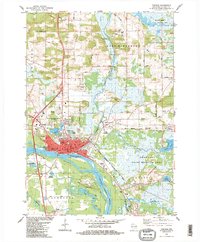
1984 Map of Portage
USGS Topo · Published 1984About this map
The Portage Canal serves as the central artery of this landscape, connecting the Wisconsin River and the Fox River at their closest point. This historic waterway was once the vital link for trade between the Great Lakes and the Mississippi River watershed. The city of Portage is densely mapped, showing civic structures like City Hall, the Wis Hospital, and several parish landmarks including St Marys Ch and St Johns Sch.
Find a feature on this map
72 named features on this map. Tap any name to fly to it.
Don’t see what you’re looking for? This feature index may not catch every label — zoom into the map to look around manually.
Map Details
Editions of this 1984 Portage Map
2 editions found
Other maps of this area

1895 · Baraboo
USGS Topo · 1:62,500

1901 · Poynette
USGS Topo · 1:62,500

1902 · Portage
USGS Topo · 1:62,500

1902 · Briggsville
USGS Topo · 1:62,500

1908 · Baraboo
USGS Topo · 1:62,500

1957 · Madison
USGS Topo · 1:250,000

1958 · Briggsville
USGS Topo · 1:62,500

1959 · Baraboo
USGS Topo · 1:62,500

1960 · Madison
USGS Topo · 1:250,000

1962 · Poynette
USGS Topo · 1:62,500