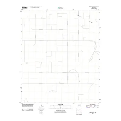
2010 Map of Portales SE
USGS Topo · Published 2010About this map
Portales Valley defines the landscape of this portion of Roosevelt County, where a disciplined grid of rural roads supports the local agricultural economy. The land is organized by an extensive network of thoroughfares, including S Roosevelt Road P and S Roosevelt Road Q, which facilitate movement between scattered homesteads and larger regional hubs. A notable localized landmark is the Howl Ranch, situated in the southeastern quadrant. The map illustrates a contemporary pattern of land use where historic ranching legacy meets modern infrastructure, shown through the precise alignment of roads like S Roosevelt Road S and S Roosevelt Road 16.
Find a feature on this map
15 named features on this map. Tap any name to fly to it.
Don’t see what you’re looking for? This feature index may not catch every label — zoom into the map to look around manually.
Map Details
Editions of this 2010 Portales SE Map
This is the sole edition of this map. No revisions or reprints were ever made.
Other maps of this area

1954 · Clovis
USGS Topo · 1:250,000

1954 · Brownfield
USGS Topo · 1:250,000

1957 · Arch
USGS Topo · 1:62,500

1957 · Portales
USGS Topo · 1:62,500

1958 · Brownfield
USGS Topo · 1:250,000

1958 · Clovis
USGS Topo · 1:250,000

1962 · Brownfield
USGS Topo · 1:250,000

1972 · Dora NW
USGS Topo · 1:24,000
1972 · Causey West
USGS Topo · 1:24,000

1972 · Dora
USGS Topo · 1:24,000