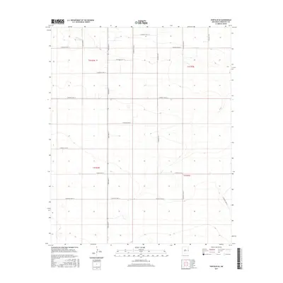
2017 Map of Portales SE
USGS Topo · Published 2017About this map
Dora Main St serves as the primary north-south artery through this rural portion of Roosevelt County, illustrating the strict gridiron survey system that defines the Llano Estacado. The landscape is characterized by its agricultural regularity, divided by a network of numbered and lettered routes such as S Roosevelt Road 10 and S Roosevelt Road 12. This 2017 survey reflects the enduring section-line road pattern established by the Public Land Survey System, specifically within Townships 2 and 3 South and Ranges 34 and 35 East. The lack of concentrated settlements or named natural water bodies emphasizes the high-plains character of the region, where land use is almost entirely dictated by the accessibility provided by thoroughfares like S Roosevelt Road 16 and S Roosevelt Road Q.
Find a feature on this map
21 named features on this map. Tap any name to fly to it.
Don’t see what you’re looking for? This feature index may not catch every label — zoom into the map to look around manually.
Map Details
Editions of this 2017 Portales SE Map
This is the sole edition of this map. No revisions or reprints were ever made.
Other maps of this area

1954 · Clovis
USGS Topo · 1:250,000

1954 · Brownfield
USGS Topo · 1:250,000

1957 · Arch
USGS Topo · 1:62,500

1957 · Portales
USGS Topo · 1:62,500

1958 · Brownfield
USGS Topo · 1:250,000

1958 · Clovis
USGS Topo · 1:250,000

1962 · Brownfield
USGS Topo · 1:250,000

1972 · Dora NW
USGS Topo · 1:24,000
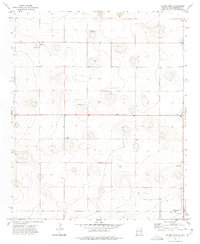
1972 · Causey West
USGS Topo · 1:24,000

1972 · Dora
USGS Topo · 1:24,000