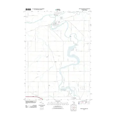
2011 Map of Portland North
USGS Topo · Published 2011About this map
The confluence of the Maple River and the Grand River defines the landscape of Ionia County, where the historic riverside villages of Muir and Lyons were established. This 2011 survey illustrates the continued reliance on the river system for power and utility, tracing the locations of the Wagar Dam, Weber Dam, and the Portland Municipal Dam. For local historians and genealogists, the map provides precise locations for several regional burial grounds, including the Lyons Township Cemetery, Keefer Cemetery, and Musser Cemetery. The layout of the road network, including the prominent Keefer Hwy and Sunfield Hwy, connects these river towns to the village of Collins and the northern edge of Portland. The presence of the Muir Post Office and Lyons Post Office serves to anchor the municipal centers within this agrarian and industrial corridor.
Find a feature on this map
75 named features on this map. Tap any name to fly to it.
Don’t see what you’re looking for? This feature index may not catch every label — zoom into the map to look around manually.
Map Details
Editions of this 2011 Portland North Map
This is the sole edition of this map. No revisions or reprints were ever made.
Other maps of this area

1916 · Ionia
USGS Topo · 1:62,500

1918 · Ionia
USGS Topo · 1:62,500

1943 · Ionia
USGS Topo · 1:62,500

1945 · Portland
USGS Topo · 1:62,500

1954 · Midland
USGS Topo · 1:250,000

1958 · Midland
USGS Topo · 1:250,000

1958 · Grand Rapids
USGS Topo · 1:250,000

1959 · Midland
USGS Topo · 1:250,000

1961 · Grand Rapids
USGS Topo · 1:250,000

1962 · Grand Rapids
USGS Topo · 1:250,000