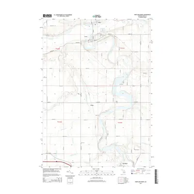
2014 Map of Portland North
USGS Topo · Published 2014About this map
The confluence of the Maple River and the Grand River anchors this central Michigan landscape, where the neighboring settlements of Muir and Lyons developed along the water's edge. This 2014 survey documents a region defined by its complex drainage network, including small tributaries like Libhart Cr, Ayers Br, and Dry Cr, which carve through the agricultural townships. The distribution of family-named burial sites such as Keefer Cem and Musser Cem alongside the more isolated Brown Grave provides essential data points for local genealogy and land-use history. Moving south through the small community of Collins toward the northern outskirts of Portland, the map reveals a well-established rural infrastructure of named roads and drains, such as Carbaugh Drain and Balderson Drain, which have long supported the area's farming economy.
Find a feature on this map
88 named features on this map. Tap any name to fly to it.
Don’t see what you’re looking for? This feature index may not catch every label — zoom into the map to look around manually.
Map Details
Editions of this 2014 Portland North Map
This is the sole edition of this map. No revisions or reprints were ever made.
Other maps of this area

1916 · Ionia
USGS Topo · 1:62,500

1918 · Ionia
USGS Topo · 1:62,500

1943 · Ionia
USGS Topo · 1:62,500

1945 · Portland
USGS Topo · 1:62,500

1954 · Midland
USGS Topo · 1:250,000

1958 · Midland
USGS Topo · 1:250,000

1958 · Grand Rapids
USGS Topo · 1:250,000

1959 · Midland
USGS Topo · 1:250,000

1961 · Grand Rapids
USGS Topo · 1:250,000

1962 · Grand Rapids
USGS Topo · 1:250,000