2019 Map of Portland North
USGS Topo · Published 2019About this map
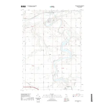
The Grand River and Maple River converge in this part of Ionia County, shaping a landscape defined by sharp river bends and a network of tributary drains. The small settlements of Muir and Lyons sit at the northern end of the map, while Portland occupies the southern reach. A significant modern conversion of the region's rail heritage is visible in the Fred Meijer Clinton-Ionia-Shiawassee (CIS) State Trail, which cuts across the northern terrain following former track beds. For those researching local families, the map identifies several distinct burial sites including Lyons Township Cem, Keefer Cem, and Musser Cem, as well as the singular Brown Grave located near Collins. The mapping of small waterways like Ayers Br and Dry Cr illustrates the drainage patterns essential to the area's agricultural development.
Find a feature on this map
92 named features on this map. Tap any name to fly to it.
Don’t see what you’re looking for? This feature index may not catch every label — zoom into the map to look around manually.
Map Details
Editions of this 2019 Portland North Map
This is the sole edition of this map. No revisions or reprints were ever made.
Other maps of this area

1916 · Ionia
USGS Topo · 1:62,500

1918 · Ionia
USGS Topo · 1:62,500

1943 · Ionia
USGS Topo · 1:62,500

1945 · Portland
USGS Topo · 1:62,500

1954 · Midland
USGS Topo · 1:250,000

1958 · Midland
USGS Topo · 1:250,000

1958 · Grand Rapids
USGS Topo · 1:250,000

1959 · Midland
USGS Topo · 1:250,000

1961 · Grand Rapids
USGS Topo · 1:250,000

1962 · Grand Rapids
USGS Topo · 1:250,000