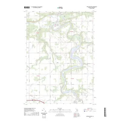
2023 Map of Portland North
USGS Topo · Published 2023About this map
The confluence of the Grand River and the Maple River defines the landscape of this Ionia County region, where the settlements of Muir and Lyons sit adjacent to one another along the riverbanks. The modern infrastructure reflects a layer of history where old rail corridors have been repurposed, such as the Fred Meijer Clinton-Ionia-Shiawassee (cis) State Trl running through the northern sector. The map serves as a vital resource for genealogists, documenting burial sites across the township including Lyons Township Cem, Keefer Cem, and the Union Burial Ground. Farther south, the small community of Collins sits near Ayers Branch, while the northern edge of Portland appears at the bottom of the sheet. Recreational use of the river is highlighted by the Middle Grand River Water Trl, which follows the winding course of the Grand River through several township sections.
Find a feature on this map
96 named features on this map. Tap any name to fly to it.
Don’t see what you’re looking for? This feature index may not catch every label — zoom into the map to look around manually.
Map Details
Editions of this 2023 Portland North Map
This is the sole edition of this map. No revisions or reprints were ever made.
Other maps of this area

1916 · Ionia
USGS Topo · 1:62,500

1918 · Ionia
USGS Topo · 1:62,500

1943 · Ionia
USGS Topo · 1:62,500

1945 · Portland
USGS Topo · 1:62,500

1954 · Midland
USGS Topo · 1:250,000

1958 · Midland
USGS Topo · 1:250,000

1958 · Grand Rapids
USGS Topo · 1:250,000

1959 · Midland
USGS Topo · 1:250,000

1961 · Grand Rapids
USGS Topo · 1:250,000

1962 · Grand Rapids
USGS Topo · 1:250,000