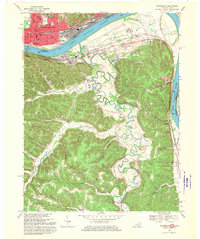
1968 Map of Portsmouth
USGS Topo · Published 1970About this map
Portsmouth anchors this riverfront landscape at the convergence of the Ohio River and the winding Tygarts Creek. The urban grid of the Ohio side, protected by its prominent Wall, contrasts with the narrow valleys and ridges of Greenup County, Kentucky. This 1968 revision documents a period of significant educational and civic infrastructure, featuring the Ohio University Portsmouth Branch and numerous local schools like Lincoln Sch and Stanton Sch. The map reveals the industrial and transit character of the river valley, where the B & O RR and Chesapeake And Ohio railroads parallel the water, and the U S Grant Bridge provides a critical interstate link.
Find a feature on this map
76 named features on this map. Tap any name to fly to it.
Don’t see what you’re looking for? This feature index may not catch every label — zoom into the map to look around manually.
Map Details
Editions of this 1968 Portsmouth Map
2 editions found
Other maps of this area

1911 · Sciotoville
USGS Topo · 1:62,500

1913 · Sciotoville
USGS Topo · 1:62,500

1915 · Garrison
USGS Topo · 1:62,500

1915 · Otway
USGS Topo · 1:62,500

1917 · Otway
USGS Topo · 1:62,500

1918 · Garrison
USGS Topo · 1:62,500

1926 · Greenup
USGS Topo · 1:48,000

1930 · Greenup
USGS Topo · 1:62,500

1949 · Friendship
USGS Topo · 1:24,000

1949 · Brushart
USGS Topo · 1:24,000