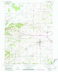
1959 Map of Poseyville
USGS Topo · Published 1981About this map
Poseyville serves as the primary hub of this landscape, situated at the intersection of significant transportation corridors during the mid-to-late 20th century. The town is anchored by the crossing of the Illinois Central Gulf Railroad and the Louisville and Nashville Railroad, reflecting the region's historical reliance on rail for commerce and travel. The agricultural character of the area is punctuated by specialized industries, notably the Oil Field Bethel and numerous distributed oil wells, which indicate a dual economy of farming and resource extraction.
Find a feature on this map
46 named features on this map. Tap any name to fly to it.
Don’t see what you’re looking for? This feature index may not catch every label — zoom into the map to look around manually.
Map Details
Editions of this 1959 Poseyville Map
4 editions found
Other maps of this area

1901 · Princeton
USGS Topo · 1:62,500

1901 · Haubstadt
USGS Topo · 1:62,500

1903 · Haubstadt
USGS Topo · 1:62,500

1903 · New Harmony
USGS Topo · 1:62,500

1903 · Princeton
USGS Topo · 1:62,500

1903 · Patoka
USGS Topo · 1:125,000

1904 · Mount Carmel
USGS Topo · 1:62,500

1938 · New Harmony
USGS Topo · 1:62,500

1956 · Vincennes
USGS Topo · 1:250,000

1957 · Vincennes
USGS Topo · 1:250,000