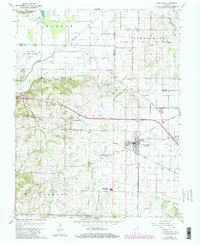
1959 Map of Poseyville
USGS Topo · Published 1981About this map
The rail junction at Poseyville serves as the focal point for this Southwest Indiana landscape, where the Illinois Central Gulf and Louisville and Nashville lines intersect. The map documents a rural society structured around local gathering places, from the North Posey County Sch to numerous denominational centers like Bethsaida Ch, Old Union Ch, and Bethlehem Ch. The terrain varies from the level bottomlands of the Black River to the distinctive Foote Pond Hills in the northwest corner, near the Wabash riverbank. Genealogists will find a high density of family and community burial grounds, including the Stallings Cem, Homer Cem, and Sale Cem. In the north, the Oil Field Bethel and scattered wells near Higginbotham Ditch reveal the area's mid-century petroleum industry.
Find a feature on this map
38 named features on this map. Tap any name to fly to it.
Don’t see what you’re looking for? This feature index may not catch every label — zoom into the map to look around manually.
Map Details
Editions of this 1959 Poseyville Map
4 editions found
Other maps of this area

1901 · Princeton
USGS Topo · 1:62,500

1901 · Haubstadt
USGS Topo · 1:62,500

1903 · Haubstadt
USGS Topo · 1:62,500

1903 · New Harmony
USGS Topo · 1:62,500

1903 · Princeton
USGS Topo · 1:62,500

1903 · Patoka
USGS Topo · 1:125,000

1904 · Mount Carmel
USGS Topo · 1:62,500

1938 · New Harmony
USGS Topo · 1:62,500

1956 · Vincennes
USGS Topo · 1:250,000

1957 · Vincennes
USGS Topo · 1:250,000