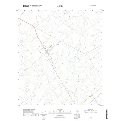
2019 Map of Poth
USGS Topo · Published 2019About this map
The town of Poth serves as the focal point of this South Texas landscape, situated along a primary transportation corridor near the boundary of Wilson County and Karnes County. The residential grid of the settlement is clearly defined by historic street names like North Storts Street and Railroad Street, reflecting its early connection to rail transport. Just north of the town center lies the Lutheran Cemetery, a significant site for local genealogical research. The natural geography is dominated by the winding course of the San Antonio River to the southwest, while the eastern portion of the quadrangle is etched by the drainage networks of Marcelinas Creek and Pulaski Creek. An industrial legacy is present in the form of the Panna Maria Tailings Pond, located southeast of the main settlement near several country roads.
Find a feature on this map
61 named features on this map. Tap any name to fly to it.
Don’t see what you’re looking for? This feature index may not catch every label — zoom into the map to look around manually.
Map Details
Editions of this 2019 Poth Map
This is the sole edition of this map. No revisions or reprints were ever made.
Other maps of this area

1920 · Smiley
USGS Topo · 1:125,000

1925 · Tordia No. 1
USGS Topo · 1:48,000

1931 · Falls City
USGS Topo · 1:62,500

1936 · Floresville
USGS Topo · 1:62,500

1953 · Crystal City
USGS Topo · 1:250,000

1953 · Beeville
USGS Topo · 1:250,000

1953 · Seguin
USGS Topo · 1:250,000

1954 · San Antonio
USGS Topo · 1:250,000

1955 · Crystal City
USGS Topo · 1:250,000

1956 · Beeville
USGS Topo · 1:250,000