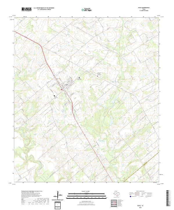
2022 Map of Poth
USGS Topo · Published 2022About this map
The settlement of Poth serves as the primary hub of this landscape, situated along a transportation corridor that includes Railroad St and several Farm-to-Market roads. The town's social fabric is reflected in its local landmarks, including the Saint Johns Lutheran Cem, the Blessed Sacrament Cem, and the Emmanuel Assembly of God Cem located to the northeast. This part of Texas is defined by its water systems, most notably the San Antonio River which winds through the southwestern portion of the sheet, joined by several drainages such as Olmos Cr and Marcelinas Cr.
Find a feature on this map
60 named features on this map. Tap any name to fly to it.
Don’t see what you’re looking for? This feature index may not catch every label — zoom into the map to look around manually.
Map Details
Editions of this 2022 Poth Map
This is the sole edition of this map. No revisions or reprints were ever made.
Other maps of this area

1920 · Smiley
USGS Topo · 1:125,000

1925 · Tordia No. 1
USGS Topo · 1:48,000

1931 · Falls City
USGS Topo · 1:62,500

1936 · Floresville
USGS Topo · 1:62,500

1953 · Crystal City
USGS Topo · 1:250,000

1953 · Beeville
USGS Topo · 1:250,000

1953 · Seguin
USGS Topo · 1:250,000

1954 · San Antonio
USGS Topo · 1:250,000

1955 · Crystal City
USGS Topo · 1:250,000

1956 · Beeville
USGS Topo · 1:250,000