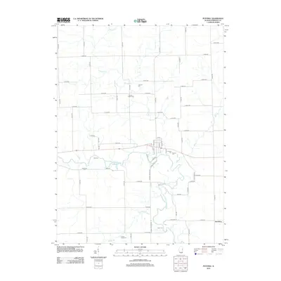
2012 Map of Potomac
USGS Topo · Published 2012About this map
The Middle Fork Vermilion River meanders across this Vermilion County landscape, defining the rural character of the region. This 2012 survey illustrates the enduring agricultural grid system, punctuated by several historic river crossings such as Bass Ford, Gray Ford, and Selsor Ford. These points provide significant insight into the historical movement of goods and people before modern infrastructure fully bridged the waterway. The settlement of Jamesburg sits at the eastern edge, while the central hub of Potomac is detailed with its local street names like N May St and N Lane St. Genealogists will find a high concentration of burial sites throughout the township, including the Potomac Cem, Ingersoll Cem, Wallace Chapel Cem, and the remote Old Partlow Cem. The drainage patterns of Bluegrass Cr and Bean Cr further delineate the local topography.
Find a feature on this map
58 named features on this map. Tap any name to fly to it.
Don’t see what you’re looking for? This feature index may not catch every label — zoom into the map to look around manually.
Map Details
Editions of this 2012 Potomac Map
This is the sole edition of this map. No revisions or reprints were ever made.
Other maps of this area

1899 · Danville
USGS Topo · 1:62,500

1900 · Danville
USGS Topo · 1:62,500

1931 · Fithian
USGS Topo · 1:48,000

1933 · Hoopeston
USGS Topo · 1:48,000

1936 · Potomac
USGS Topo · 1:62,500

1938 · Hoopeston
USGS Topo · 1:62,500

1943 · Fithian
USGS Topo · 1:62,500

1948 · Danville NW
USGS Topo · 1:24,000

1950 · Danville NW
USGS Topo · 1:24,000

1953 · Danville
USGS Topo · 1:250,000