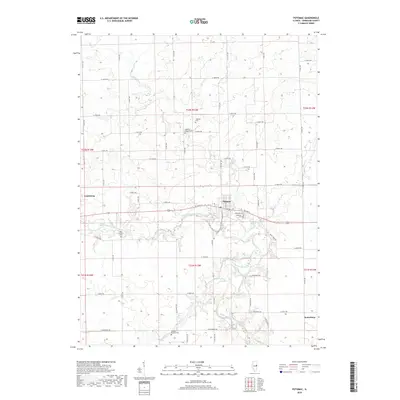
2018 Map of Potomac
USGS Topo · Published 2018About this map
The Middle Fork Vermilion River carves a winding path through this corner of Vermilion County, defining the agricultural landscape of east-central Illinois. The village of Potomac serves as the primary hub, situated near the intersection of W State St and S Vermilion St. This area is particularly dense with small family and community burial sites, offering significant genealogical value through the presence of Potomac Cem, Ingersoll Cem, and the Old Partlow Cem along the river bluffs. Further south, the Knight's Branch Cem sits near Knights Br, illustrating a pattern of settlement tied closely to the numerous tributaries like Bluegrass Cr and Bean Cr. The rectilinear road network, including routes like E 3400 N RD, highlights the enduring township-and-range surveying system that governs this productive farmland.
Find a feature on this map
62 named features on this map. Tap any name to fly to it.
Don’t see what you’re looking for? This feature index may not catch every label — zoom into the map to look around manually.
Map Details
Editions of this 2018 Potomac Map
This is the sole edition of this map. No revisions or reprints were ever made.
Other maps of this area

1899 · Danville
USGS Topo · 1:62,500

1900 · Danville
USGS Topo · 1:62,500

1931 · Fithian
USGS Topo · 1:48,000

1933 · Hoopeston
USGS Topo · 1:48,000

1936 · Potomac
USGS Topo · 1:62,500

1938 · Hoopeston
USGS Topo · 1:62,500

1943 · Fithian
USGS Topo · 1:62,500

1948 · Danville NW
USGS Topo · 1:24,000

1950 · Danville NW
USGS Topo · 1:24,000

1953 · Danville
USGS Topo · 1:250,000