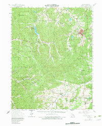
1958 Map of Potosi
USGS Topo · Published 1983About this map
Potosi anchors this 1950s survey of Washington County, Missouri, where the extractive lead-mining history of the region is visible in the numerous mines and tailings ponds scattered near the town center. The landscape transitions from the developed industrial and civic center of Potosi into the protected woods of the Mark Twain National Forest, which covers a significant portion of the western half of the map.
Find a feature on this map
80 named features on this map. Tap any name to fly to it.
Don’t see what you’re looking for? This feature index may not catch every label — zoom into the map to look around manually.
Map Details
Editions of this 1958 Potosi Map
3 editions found
Other maps of this area

1901 · De Soto
USGS Topo · 1:125,000

1903 · Sullivan
USGS Topo · 1:125,000

1905 · Bonneterre
USGS Topo · 1:62,500

1906 · Potosi
USGS Topo · 1:62,500

1924 · Edgehill
USGS Topo · 1:62,500

1926 · Edgehill
USGS Topo · 1:62,500

1937 · Ironton
USGS Topo · 1:48,000

1937 · Tiff
USGS Topo · 1:24,000

1939 · Tiff
USGS Topo · 1:24,000

1943 · Berryman
USGS Topo · 1:62,500