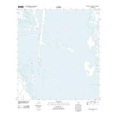
2010 Map of Potrero Lopeno SW
USGS Topo · Published 2010About this map
Laguna Madre dominates this coastal landscape, serving as a shallow hypersaline lagoon that separates the mainland from the barrier islands of the Texas coast. The maritime character of the region is defined by the Intracoastal Waterway, a critical navigation channel that cuts through the bay to support commercial shipping and local transit. Along the western edge, the landform Rincon de San Jose reaches into the water, while the eastern portion of the map is anchored by the shifting sands of Padre Island. A distinctive geographic marker, Southeast Point, designates a prominent turn in the coastal topography where land and water meet in a complex system of shoals and flats. This 2010 survey provides a clear look at the undeveloped coastline and natural hydrology before further environmental shifts altered these specific shorelines.
Find a feature on this map
5 named features on this map. Tap any name to fly to it.
Don’t see what you’re looking for? This feature index may not catch every label — zoom into the map to look around manually.
Map Details
Editions of this 2010 Potrero Lopeno SW Map
This is the sole edition of this map. No revisions or reprints were ever made.
Other maps of this area

1921 · Tarida Ranch
USGS Topo · 1:62,500

1923 · Lopena Island
USGS Topo · 1:62,500

1923 · Saltillo Ranch
USGS Topo · 1:62,500

1951 · South of Potrero Lopeno NE
USGS Topo · 1:24,000

1951 · Potrero Lopeno NW
USGS Topo · 1:24,000

1952 · Potrero Lopeno SE
USGS Topo · 1:24,000

1952 · South of Potrero Lopeno NW
USGS Topo · 1:24,000

1952 · Potrero Lopeno SW
USGS Topo · 1:24,000

1952 · Potrero Lopeno
USGS Topo · 1:62,500

1952 · South of Potrero Lopeno
USGS Topo · 1:62,500