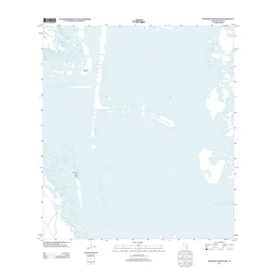
2013 Map of Potrero Lopeno SW
USGS Topo · Published 2013About this map
The coastal transition of the Texas Gulf shore appears in this 2013 topographic study by the United States Geological Survey. Dominated by the intricate hydrography of the Laguna Madre, the landscape features isolated landforms like Rincon de San Jose and the navigational marker at Southeast Point. This map provides a detailed view of the shifting sands and shallow wetlands characteristic of the Kenedy County coastline, offering an important record of the coastal environment before more recent environmental changes. The presence of shallow waters and intricate shoreline patterns reveals the natural barriers that have historically shaped the region's limited development and maritime navigation.
Find a feature on this map
2 named features on this map. Tap any name to fly to it.
Don’t see what you’re looking for? This feature index may not catch every label — zoom into the map to look around manually.
Map Details
Editions of this 2013 Potrero Lopeno SW Map
This is the sole edition of this map. No revisions or reprints were ever made.
Other maps of this area

1921 · Tarida Ranch
USGS Topo · 1:62,500

1923 · Lopena Island
USGS Topo · 1:62,500

1923 · Saltillo Ranch
USGS Topo · 1:62,500

1951 · South of Potrero Lopeno NE
USGS Topo · 1:24,000

1951 · Potrero Lopeno NW
USGS Topo · 1:24,000

1952 · Potrero Lopeno SE
USGS Topo · 1:24,000

1952 · South of Potrero Lopeno NW
USGS Topo · 1:24,000

1952 · Potrero Lopeno SW
USGS Topo · 1:24,000

1952 · Potrero Lopeno
USGS Topo · 1:62,500

1952 · South of Potrero Lopeno
USGS Topo · 1:62,500