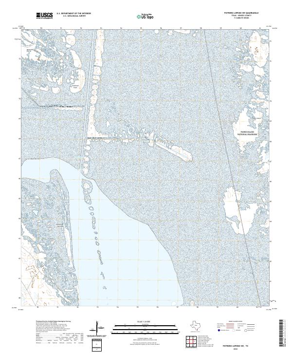
2022 Map of Potrero Lopeno SW
USGS Topo · Published 2022About this map
Padre Island National Seashore dominates the eastern landscape of this coastal survey, where the barrier island meets the Laguna Madre. The terrain is defined by the shifting interface of water and land, featuring coastal landforms like Southeast Point and Padre Island itself. On the mainland side, the geography is marked by distinctive elevations and points such as Mesquite Rincon and Rincon de San Jose. A single identified thoroughfare, E Turcotte Rd, provides the primary land access in the northwest corner, reflecting the remote and preserved nature of this Kenedy County coastline. The map illustrates a largely undeveloped stretch of the Texas coast, where the focus remains on the natural topography and the boundaries of the national seashore.
Find a feature on this map
6 named features on this map. Tap any name to fly to it.
Don’t see what you’re looking for? This feature index may not catch every label — zoom into the map to look around manually.
Map Details
Editions of this 2022 Potrero Lopeno SW Map
This is the sole edition of this map. No revisions or reprints were ever made.
Other maps of this area

1921 · Tarida Ranch
USGS Topo · 1:62,500

1923 · Lopena Island
USGS Topo · 1:62,500

1923 · Saltillo Ranch
USGS Topo · 1:62,500

1951 · South of Potrero Lopeno NE
USGS Topo · 1:24,000

1951 · Potrero Lopeno NW
USGS Topo · 1:24,000

1952 · Potrero Lopeno SE
USGS Topo · 1:24,000

1952 · South of Potrero Lopeno NW
USGS Topo · 1:24,000

1952 · Potrero Lopeno SW
USGS Topo · 1:24,000

1952 · Potrero Lopeno
USGS Topo · 1:62,500

1952 · South of Potrero Lopeno
USGS Topo · 1:62,500