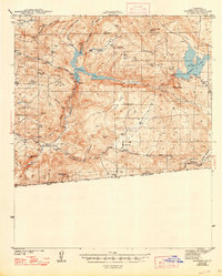
1944 Map of Potrero
USGS Topo · Published 1948About this map
Potrero serves as the focal point of this 1940s topography, situated in a valley south of the Cleveland National Forest. The map documents a critical infrastructure network for San Diego's water supply, dominated by the reservoir at Barrett Lake and the Barrett Dam, alongside Lake Morena to the east. Along the southern border, the international boundary with Mexico is clearly marked, featuring the border crossing at Tecate and its Custom House. The transit corridor is defined by the San Diego & Arizona Eastern railroad, which follows Campo Creek through Canyon City. Local civic life is anchored by rural institutions like the Potrero Sch and Barrett Sch, while family-named landmarks such as the McAlmond Ranch and Stokes Valley suggest the ranching character of the landscape during the war years.
Find a feature on this map
47 named features on this map. Tap any name to fly to it.
Don’t see what you’re looking for? This feature index may not catch every label — zoom into the map to look around manually.
Map Details
Editions of this 1944 Potrero Map
2 editions found

Other maps of this area

1893 · El Cajon
USGS Topo · 1:62,500

1901 · Elcajon
USGS Topo · 1:62,500

1903 · Cuyamaca
USGS Topo · 1:125,000

1903 · Elcajon
USGS Topo · 1:62,500

1904 · Southern California Sheet No. 2
USGS Topo · 1:250,000

1931 · Carrizo
USGS Topo · 1:125,000

1939 · El Cajon
USGS Topo · 1:62,500

1939 · Campo
USGS Topo · 1:62,500

1942 · Potrero
USGS Topo · 1:48,000

1942 · El Cajon
USGS Topo · 1:62,500