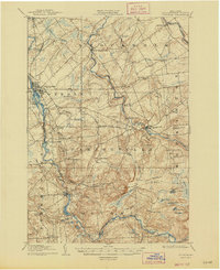
1908 Map of Potsdam
USGS Topo · Published 1947About this map
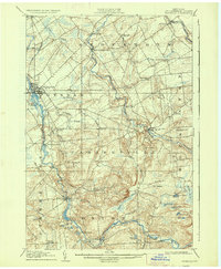
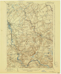
The Raquette River dominates the western half of this St. Lawrence County landscape, powering the industry and settlement patterns of Potsdam and Colton at the turn of the century. Along its banks and the neighboring St Regis River, numerous water-driven features like Rainbow Falls and Gain Twist Falls speak to the region's hydraulic resources. The New York Central railroad provides the primary industrial artery, passing through the growing hub of Norwood.
Find a feature on this map
63 named features on this map. Tap any name to fly to it.
Don’t see what you’re looking for? This feature index may not catch every label — zoom into the map to look around manually.
Map Details
Editions of this 1908 Potsdam Map
7 editions found
Other maps of this area

1905 · Waddington
USGS Topo · 1:62,500

1906 · Massena
USGS Topo · 1:62,500

1907 · Massena
USGS Topo · 1:62,500

1908 · Potsdam
USGS Topo · 1:62,500

1910 · Canton
USGS Topo · 1:62,500

1911 · Canton
USGS Topo · 1:62,500

1915 · Moira
USGS Topo · 1:62,500

1915 · Russell
USGS Topo · 1:62,500

1917 · Moira
USGS Topo · 1:62,500

1918 · Russell
USGS Topo · 1:62,500