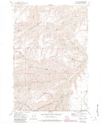
1971 Map of Potter Hill
USGS Topo · Published 1983About this map
Cloverland sits at the edge of this deeply incised canyon landscape, where the plateau of Asotin County meets the northern reaches of the Umatilla National Forest. The map documents a rugged network of drainage gulches and high divides, most notably Tam Tam Ridge and Flerchinger Ridge, which separate the various forks of Charley Creek and Asotin Creek. This geography created significant challenges for early movement, evidenced by the winding path of Campbell Grade and the Cloverland Road as they negotiate the steep elevation changes. Scattered springs such as Rimmelspacher Spring and Laufer Spring provided essential water sources in this dry, high-elevation environment. The presence of several borrow pits and a Quarry suggests local material extraction was critical for maintaining the essential access roads like the Jeep Trail networks that crisscross the ridges.
Find a feature on this map
42 named features on this map. Tap any name to fly to it.
Don’t see what you’re looking for? This feature index may not catch every label — zoom into the map to look around manually.
Map Details
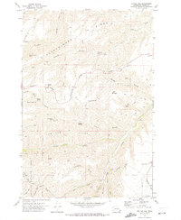
Editions of this 1971 Potter Hill Map
2 editions found
Other maps of this area

1943 · Peola
USGS Topo · 1:62,500

1943 · Saddle Butte
USGS Topo · 1:62,500

1944 · Anatone
USGS Topo · 1:62,500

1945 · Clarkston
USGS Topo · 1:62,500

1946 · Saddle Butte
USGS Topo · 1:62,500

1946 · Peola
USGS Topo · 1:62,500

1946 · Anatone
USGS Topo · 1:62,500

1948 · Clarkston
USGS Topo · 1:62,500

1955 · Pullman
USGS Topo · 1:250,000

1958 · Pullman
USGS Topo · 1:250,000