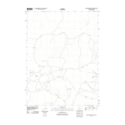
2010 Map of Powder Mountain
USGS Topo · Published 2010About this map
Powder Rim dominates this high-desert landscape in Sweetwater County, where the topography is defined by complex drainage patterns and essential water sources. This 2010 survey illustrates a region where ranching and historic travel corridors intersect. The Cherokee Trail Rd and Shell Creek Stock Trl cross the terrain, following the natural contours of the land. Water management is central to the area's utility, evidenced by a high density of small-scale impoundments including Knob Reservoir, Northwest Powder Reservoir, and Juniper Reservoir.
Find a feature on this map
23 named features on this map. Tap any name to fly to it.
Don’t see what you’re looking for? This feature index may not catch every label — zoom into the map to look around manually.
Map Details
Editions of this 2010 Powder Mountain Map
This is the sole edition of this map. No revisions or reprints were ever made.
Other maps of this area

1954 · Vernal
USGS Topo · 1:250,000

1954 · Rock Springs
USGS Topo · 1:250,000

1958 · Vernal
USGS Topo · 1:250,000

1958 · Rock Springs
USGS Topo · 1:250,000

1960 · Vernal
USGS Topo · 1:250,000

1962 · Rock Springs
USGS Topo · 1:250,000

1969 · Reservoir Draw
USGS Topo · 1:24,000
1969 · The Nipple NE
USGS Topo · 1:24,000

1969 · Powder Wash
USGS Topo · 1:24,000

1970 · Prehistoric Rim
USGS Topo · 1:24,000