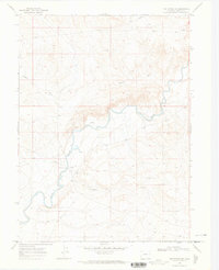
1969 Map of The Nipple NE
USGS Topo · Published 1973About this map
The Little Snake River meanders across this corner of Moffat County, carving a distinct path through a landscape defined by drainage systems and resource extraction. Evidence of the region's energy and mineral industry is prevalent, with numerous Gas Wells, Drill Holes, and a Gravel Pit scattered across the terrain. A Flowing Well and several instances of a Spring indicate the vital presence of water in this arid stretch of Colorado. Crossing the river, the Edinger Bridge provides a primary point of transit, while Powder Wash drains into the river from the northwest. The map captures the quiet industrial activity of the late 1960s, showing a network of pipelines and unimproved roads that supported local drilling operations far from any major urban centers.
Find a feature on this map
9 named features on this map. Tap any name to fly to it.
Don’t see what you’re looking for? This feature index may not catch every label — zoom into the map to look around manually.
Map Details
Editions of this 1969 The Nipple NE Map
3 editions found
Other maps of this area

1916 · Craig
USGS Topo · 1:125,000

1954 · Vernal
USGS Topo · 1:250,000

1954 · Rawlins
USGS Topo · 1:250,000

1954 · Rock Springs
USGS Topo · 1:250,000

1954 · Craig
USGS Topo · 1:250,000

1957 · Craig
USGS Topo · 1:250,000

1958 · Rawlins
USGS Topo · 1:250,000

1958 · Vernal
USGS Topo · 1:250,000

1958 · Rock Springs
USGS Topo · 1:250,000

1958 · Craig
USGS Topo · 1:250,000