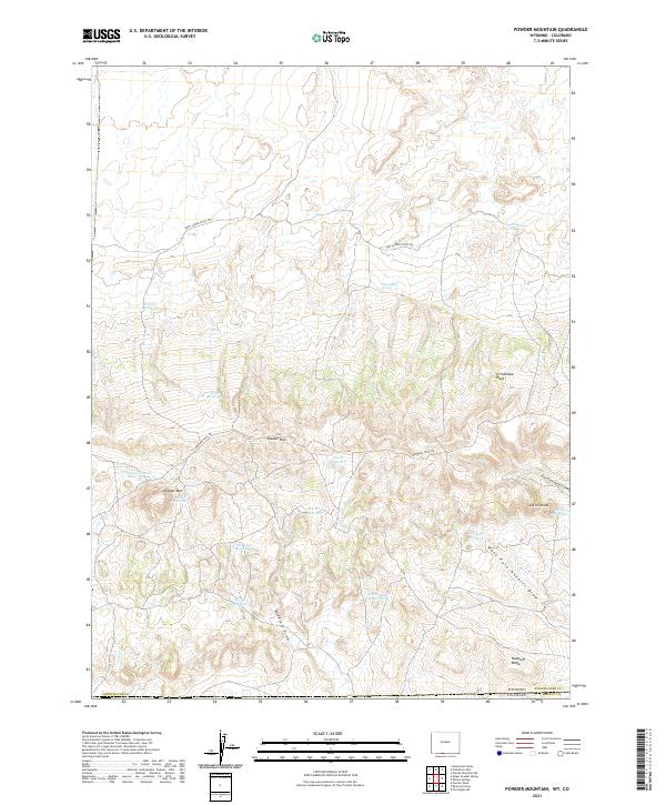
2021 Map of Powder Mountain
USGS Topo · Published 2021About this map
Powder Rim and Powder Mtn dominate this high-desert landscape in southern Sweetwater County, where the terrain transitions across the Wyoming Colorado state line. The map captures a region defined by extensive livestock and water infrastructure, essential for ranching in this arid environment. Strategic water sources such as Grindstone Spring and Moonshine Spring are mapped alongside numerous catchment basins including Salt Lick Reservoir, North Reservoir, and Sand Reservoir.
Find a feature on this map
30 named features on this map. Tap any name to fly to it.
Don’t see what you’re looking for? This feature index may not catch every label — zoom into the map to look around manually.
Map Details
Editions of this 2021 Powder Mountain Map
This is the sole edition of this map. No revisions or reprints were ever made.
Other maps of this area

1954 · Vernal
USGS Topo · 1:250,000

1954 · Rock Springs
USGS Topo · 1:250,000

1958 · Vernal
USGS Topo · 1:250,000

1958 · Rock Springs
USGS Topo · 1:250,000

1960 · Vernal
USGS Topo · 1:250,000

1962 · Rock Springs
USGS Topo · 1:250,000

1969 · Reservoir Draw
USGS Topo · 1:24,000
1969 · The Nipple NE
USGS Topo · 1:24,000

1969 · Powder Wash
USGS Topo · 1:24,000

1970 · Prehistoric Rim
USGS Topo · 1:24,000