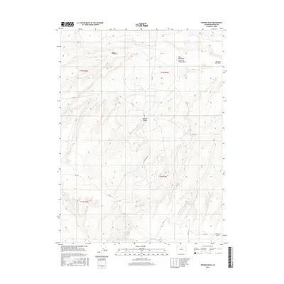
2016 Map of Powder Wash
USGS Topo · Published 2016About this map
Powder Wash anchors this high-desert landscape in Moffat County, where a network of ephemeral drainages and springs defines the remote terrain. This 2016 survey illustrates a region shaped by its hydrology, with features like Dans Hole Spring and Reservoir Draw providing vital water points in an otherwise arid environment. The map details a rugged system of coulees and draws, including the evocatively named Beaver Slide Draw, Eagle Rock Draw, and Ace in the Hole Draw. Access to this corner of Colorado is documented through a series of county roads, such as Co RD 75 and the central Cottonwood Blvd. Local landmarks like West Dripping Rock stand out against the topographical contours, offering clear reference points for those studying the natural geography or land management of the North Fork Powder Wash drainage system.
Find a feature on this map
21 named features on this map. Tap any name to fly to it.
Don’t see what you’re looking for? This feature index may not catch every label — zoom into the map to look around manually.
Map Details
Editions of this 2016 Powder Wash Map
This is the sole edition of this map. No revisions or reprints were ever made.
Other maps of this area

1954 · Vernal
USGS Topo · 1:250,000

1954 · Rock Springs
USGS Topo · 1:250,000

1958 · Vernal
USGS Topo · 1:250,000

1958 · Rock Springs
USGS Topo · 1:250,000

1960 · Vernal
USGS Topo · 1:250,000

1962 · Rock Springs
USGS Topo · 1:250,000

1969 · Reservoir Draw
USGS Topo · 1:24,000

1969 · The Nipple
USGS Topo · 1:24,000

1969 · Sheepherder Springs
USGS Topo · 1:24,000

1969 · Coffeepot Spring
USGS Topo · 1:24,000