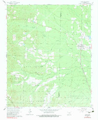
1964 Map of Poyen
USGS Topo · Published 1983About this map
Poyen serves as the central hub of this mid-century landscape, positioned along the Chicago Rock Island and Pacific railroad line near the junction of Big Creek. The area is characterized by several small rural settlements such as Gifford, Rhinehart, and Lenham, reflecting the early 1960s spatial arrangement of this portion of Arkansas. Waterways define the local geography, with Francois Creek and Clear Creek cutting through the terrain, while landmarks like the Melvern Country Club indicate the shift toward recreational land use alongside traditional agriculture.
Find a feature on this map
35 named features on this map. Tap any name to fly to it.
Don’t see what you’re looking for? This feature index may not catch every label — zoom into the map to look around manually.
Map Details
Editions of this 1964 Poyen Map
Other maps of this area

1948 · Malvern
USGS Topo · 1:62,500

1949 · Malvern
USGS Topo · 1:62,500

1955 · Little Rock
USGS Topo · 1:250,000

1956 · Little Rock
USGS Topo · 1:250,000

1960 · Little Rock
USGS Topo · 1:250,000

1963 · Traskwood
USGS Topo · 1:24,000

1963 · Prattsville
USGS Topo · 1:24,000
1963 · Tull
USGS Topo · 1:24,000

1964 · Poyen
USGS Topo · 1:24,000

1964 · Little Rock
USGS Topo · 1:250,000