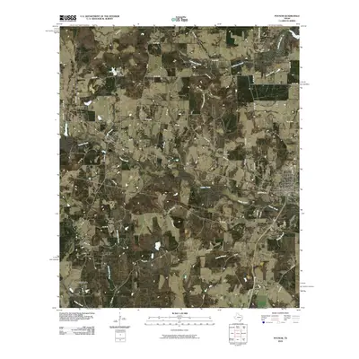
2010 Map of Poynor
USGS Topo · Published 2010About this map
Poynor and Frankston anchor this East Texas landscape, which is defined by a dense network of country roads and small creek drainages. The topography is largely dictated by the passage of Caddo Creek, which winds through the central portion of the quadrangle, and Caney Branch to the south. Notable elevations like Newman Mountain break the horizon near Liberty Hill Cemetery, while water management is evident at Mixon Lake Dam in the north. The map preserves the locations of several community burial grounds, including Poynor Cemetery and Foster Cemetery, providing a spatial record of local genealogy. From the residential streets of Coffee City near the northern boundary to the outlying settlement of Fosterville, the map illustrates a rural area where small-town centers are connected by an intricate web of Farm-to-Market and County Roads, including FM 315 and FM 1305.
Find a feature on this map
52 named features on this map. Tap any name to fly to it.
Don’t see what you’re looking for? This feature index may not catch every label — zoom into the map to look around manually.
Map Details
Editions of this 2010 Poynor Map
This is the sole edition of this map. No revisions or reprints were ever made.
Other maps of this area

1946 · Bullard
USGS Topo · 1:62,500

1948 · Bullard
USGS Topo · 1:62,500

1949 · Palestine
USGS Topo · 1:62,500

1949 · Frankston
USGS Topo · 1:62,500

1950 · Palestine
USGS Topo · 1:62,500

1950 · Frankston
USGS Topo · 1:62,500

1951 · Jacksonville
USGS Topo · 1:62,500

1953 · Palestine
USGS Topo · 1:250,000

1956 · Tyler
USGS Topo · 1:250,000

1957 · Palestine
USGS Topo · 1:250,000