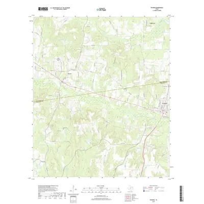
2019 Map of Poynor
USGS Topo · Published 2019About this map
Frankston and Poynor anchor this East Texas survey, which captures a landscape defined by the drainage basins of Caddo Cr and Ledbetter Cr. The area is bisected by the Henderson Co Anderson Co line, illustrating the rural interconnectedness between these two counties through an extensive network of county roads and farm-to-market routes. Local history is well-preserved through several family and community landmarks, including Poynor Cem, Liberty Hill Cem, and Foster Cem. The presence of the Pickle Plantation Airport west of Poynor and the northern settlement of Coffee City near Mixon Lake highlight the mix of agricultural tradition and modern utility. Small watercourses like Norwegian Cr and Caney Br wind through the terrain, tracing the natural hydrology that shaped early settlement patterns in this part of the Piney Woods.
Find a feature on this map
79 named features on this map. Tap any name to fly to it.
Don’t see what you’re looking for? This feature index may not catch every label — zoom into the map to look around manually.
Map Details
Editions of this 2019 Poynor Map
This is the sole edition of this map. No revisions or reprints were ever made.
Other maps of this area

1946 · Bullard
USGS Topo · 1:62,500

1948 · Bullard
USGS Topo · 1:62,500

1949 · Palestine
USGS Topo · 1:62,500

1949 · Frankston
USGS Topo · 1:62,500

1950 · Palestine
USGS Topo · 1:62,500

1950 · Frankston
USGS Topo · 1:62,500

1951 · Jacksonville
USGS Topo · 1:62,500

1953 · Palestine
USGS Topo · 1:250,000

1956 · Tyler
USGS Topo · 1:250,000

1957 · Palestine
USGS Topo · 1:250,000