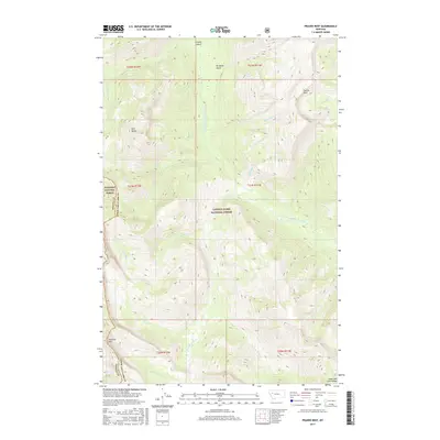
2017 Map of Prairie Reef
USGS Topo · Published 2017About this map
Prairie Reef stands as a prominent landmark in this high-altitude wilderness, marking the divide within the Lewis & Clark National Forest. The landscape is defined by the complex drainage systems of the Sun River and Ahorn Creek, where the West Fork South Fork Sun River and Lost Fork Ahorn Cr carve deep through the mountain terrain. This 2017 survey details a primitive and roadless area where the border between Lewis and Clark and Powell counties follows the high ridges of the Continental Divide, separating the Lewis & Clark from the Flathead National Forest. Significant summits like Red Butte and Junction Mtn overlook a network of seasonal watercourses, including Black Bear Cr, White Bear Cr, and Grizzly Gulch, illustrating the hydrological importance of this protected backcountry region.
Find a feature on this map
25 named features on this map. Tap any name to fly to it.
Don’t see what you’re looking for? This feature index may not catch every label — zoom into the map to look around manually.
Map Details
Editions of this 2017 Prairie Reef Map
This is the sole edition of this map. No revisions or reprints were ever made.
Other maps of this area

1902 · Ovando
USGS Topo · 1:125,000

1903 · Saypo
USGS Topo · 1:125,000

1903 · Coopers Lake
USGS Topo · 1:125,000

1905 · Ovando
USGS Topo · 1:125,000

1936 · Silvertip
USGS Topo · 1:96,000

1942 · Silvertip
USGS Topo · 1:125,000

1955 · Choteau
USGS Topo · 1:250,000

1957 · Choteau
USGS Topo · 1:250,000

1958 · Choteau
USGS Topo · 1:250,000

1958 · Glenn Creek
USGS Topo · 1:24,000