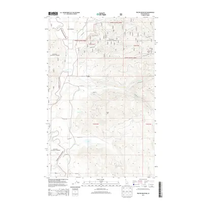
2013 Map of Prater Mountain
USGS Topo · Published 2013About this map
Priest River flows through the western reaches of the Kanisku National Forest in this 2013 topographic study, carving a valley between prominent peaks like Prater Mtn and Gisborne Mtn. The landscape is defined by a dense network of forest service roads and drainage systems, including E River, Benton Cr, and Blue Cr. Notable human footprints include the Fox Creek Airport and the Gisborne Mountain Vista, which provide access and perspective over the surrounding terrain. Small water features like McAbee Falls and Blue Lake sit tucked within the timbered slopes. The map also identifies specific clearings and meadows, such as Garten Meadow, suggesting pockets of flatter ground amidst the high-elevation relief typical of the Idaho Panhandle.
Find a feature on this map
40 named features on this map. Tap any name to fly to it.
Don’t see what you’re looking for? This feature index may not catch every label — zoom into the map to look around manually.
Map Details
Editions of this 2013 Prater Mountain Map
This is the sole edition of this map. No revisions or reprints were ever made.
Other maps of this area

1901 · Sandpoint
USGS Topo · 1:125,000

1911 · Priest Lake
USGS Topo · 1:250,000

1911 · Sandpoint
USGS Topo · 1:125,000

1913 · Priest Lake
USGS Topo · 1:250,000

1958 · Sandpoint
USGS Topo · 1:250,000

1963 · Sandpoint
USGS Topo · 1:250,000

1967 · Quartz Mtn
USGS Topo · 1:24,000

1967 · Coolin
USGS Topo · 1:24,000
1967 · Outlet Bay
USGS Topo · 1:24,000

1967 · Prater Mtn
USGS Topo · 1:24,000