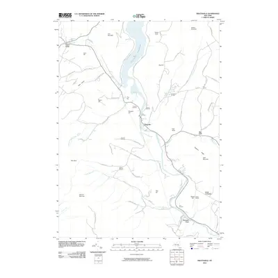
2010 Map of Prattsville
USGS Topo · Published 2010About this map
Schoharie Creek and its major tributaries, including the Batavia Kill and Little West Kill, dominate this Catskill landscape at the beginning of the 21st century. The waters of the Schoharie Reservoir fill the northern valley, fed by the Bear Kill near Hardenburgh Falls. Local history is deeply embedded in the terrain, with family-named landmarks like Maben Hill and Kipp Hill rising above the valleys, while several historic burial grounds such as Fairlawn Cemetery and Rappelea Cemetery are scattered throughout the rural landscape. The settlement of Prattsville serves as a central hub, situated near the distinctive Pratt Rocks. To the south, the terrain becomes more isolated toward Bearpen Mountain and Roundtop, while Maben Airport and the small communities of North Lexington and Mosquito Point define the eastern and southern reaches of this transition between river valley and mountain peaks.
Find a feature on this map
75 named features on this map. Tap any name to fly to it.
Don’t see what you’re looking for? This feature index may not catch every label — zoom into the map to look around manually.
Map Details
Editions of this 2010 Prattsville Map
This is the sole edition of this map. No revisions or reprints were ever made.
Other maps of this area

1900 · Phoenicia
USGS Topo · 1:62,500

1901 · Margaretville
USGS Topo · 1:62,500

1901 · Gilboa
USGS Topo · 1:62,500

1903 · Gilboa
USGS Topo · 1:62,500

1903 · Phoenicia
USGS Topo · 1:62,500

1904 · Hobart
USGS Topo · 1:62,500

1904 · Margaretville
USGS Topo · 1:62,500

1945 · West Kill
USGS Topo · 1:24,000

1945 · Gilboa
USGS Topo · 1:24,000

1945 · Fleischmanns
USGS Topo · 1:24,000