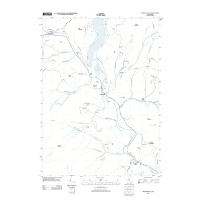
2013 Map of Prattsville
USGS Topo · Published 2013About this map
Prattsville sits at the confluence of several vital Catskill watercourses, where the Schoharie Cr meets the Batavia Kill and Huntersfield Cr. This 2013 survey illustrates a landscape defined by its narrow valleys and prominent peaks, including Pine Mountain, Bearpen Mountain, and Mount Royal. The settlement pattern follows the contours of the waterways, with small communities like Grand Gorge, North Lexington, and Red Falls linked by winding roads through gaps such as Toad Hollow. Local history is preserved in numerous family and community burial grounds, from the Grand Gorge Main Cem in the northwest to the Deyo Cem near the southern bend of the creek. Cultural landmarks like the Pratt Rocks and the Schoharie Creek Bridge highlight the intersection of the natural environment and human engineering in this part of Delaware County. The presence of Maben Airport and the specialized Mosquito Point road network shows the modern infrastructure supporting this rural mountain region.
Find a feature on this map
105 named features on this map. Tap any name to fly to it.
Don’t see what you’re looking for? This feature index may not catch every label — zoom into the map to look around manually.
Map Details
Editions of this 2013 Prattsville Map
This is the sole edition of this map. No revisions or reprints were ever made.
Other maps of this area

1900 · Phoenicia
USGS Topo · 1:62,500

1901 · Margaretville
USGS Topo · 1:62,500

1901 · Gilboa
USGS Topo · 1:62,500

1903 · Gilboa
USGS Topo · 1:62,500

1903 · Phoenicia
USGS Topo · 1:62,500

1904 · Hobart
USGS Topo · 1:62,500

1904 · Margaretville
USGS Topo · 1:62,500

1945 · West Kill
USGS Topo · 1:24,000

1945 · Gilboa
USGS Topo · 1:24,000

1945 · Fleischmanns
USGS Topo · 1:24,000