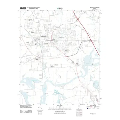
2011 Map of Prattville
USGS Topo · Published 2011About this map
Prattville is characterized by its historical industrial roots and complex river geography as it appeared in the early 21st century. The map highlights the legacy of its founder at the Daniel Pratt Cemetery and the prominence of Gin Shop Hill, marking the area's early manufacturing heritage. The landscape is defined by the winding course of Autauga Creek and the expansive Alabama River, where features like Washington Bar, Gun Island Chute, and Duncan Bar illustrate the shifting riverbed and navigation challenges.
Find a feature on this map
135 named features on this map. Tap any name to fly to it.
Don’t see what you’re looking for? This feature index may not catch every label — zoom into the map to look around manually.
Map Details
Editions of this 2011 Prattville Map
This is the sole edition of this map. No revisions or reprints were ever made.
Other maps of this area

1891 · Clanton
USGS Topo · 1:125,000

1901 · Wetumpka
USGS Topo · 1:125,000

1903 · Wetumpka
USGS Topo · 1:125,000

1927 · Montgomery
USGS Topo · 1:48,000

1930 · Montgomery
USGS Topo · 1:62,500

1953 · Montgomery
USGS Topo · 1:250,000

1956 · Montgomery
USGS Topo · 1:250,000

1957 · Montgomery
USGS Topo · 1:250,000

1957 · Autaugaville
USGS Topo · 1:62,500

1958 · Montgomery
USGS Topo · 1:62,500