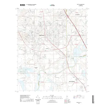
2020 Map of Prattville
USGS Topo · Published 2020About this map
Pratttville serves as the focal point of this study, positioned near the intersection of Autauga Creek and Pine Cr. The landscape is defined by its numerous family and community cemeteries, such as Daniel Pratt Cem, Oak Hill Cem, and Doster Family Cem, which offer significant genealogical value for the region. The map captures the suburban expansion around Millbrook and Fays alongside the industrial presence of the Pratttville Industrial Board Waste Pond.
Find a feature on this map
230 named features on this map. Tap any name to fly to it.
Don’t see what you’re looking for? This feature index may not catch every label — zoom into the map to look around manually.
Map Details
Editions of this 2020 Prattville Map
This is the sole edition of this map. No revisions or reprints were ever made.
Other maps of this area

1891 · Clanton
USGS Topo · 1:125,000

1901 · Wetumpka
USGS Topo · 1:125,000

1903 · Wetumpka
USGS Topo · 1:125,000

1927 · Montgomery
USGS Topo · 1:48,000

1930 · Montgomery
USGS Topo · 1:62,500

1953 · Montgomery
USGS Topo · 1:250,000

1956 · Montgomery
USGS Topo · 1:250,000

1957 · Montgomery
USGS Topo · 1:250,000

1957 · Autaugaville
USGS Topo · 1:62,500

1958 · Montgomery
USGS Topo · 1:62,500