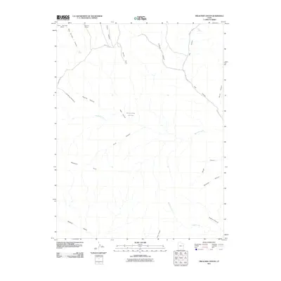
2011 Map of Preacher Canyon
USGS Topo · Published 2011About this map
Diamond Ridge Gas Field represents the industrial footprint in this high-desert landscape of Grand County, Utah, where energy extraction meets a complex network of drainages. The topography is defined by prominent mesas and steep-walled canyons, including Rock Springs Mesa and Cherry Mesa to the north, which give way to the eponymous Preacher Canyon and the winding Hay Canyon. These deep incisions in the earth dictate the path of sparse infrastructure, such as the Book Cliff Ridge Rd and Moon Ridge Rd, which trace the higher elevations to navigate the broken terrain. Vital water sources like Rock Spring and Red Spring are recorded along these drainages, serving as critical landmarks in an otherwise arid environment. The map details the headwaters of significant washes, most notably Westwater Creek and Sulphur Creek, illustrating the natural drainage patterns that flow toward the broader canyon systems of the region.
Find a feature on this map
25 named features on this map. Tap any name to fly to it.
Don’t see what you’re looking for? This feature index may not catch every label — zoom into the map to look around manually.
Map Details
Editions of this 2011 Preacher Canyon Map
This is the sole edition of this map. No revisions or reprints were ever made.
Other maps of this area

1885 · East Tavaputs
USGS Topo · 1:250,000

1956 · Grand Junction
USGS Topo · 1:250,000

1959 · Grand Junction
USGS Topo · 1:250,000

1960 · Grand Junction
USGS Topo · 1:250,000

1962 · Grand Junction
USGS Topo · 1:250,000

1963 · Tenmile Canyon
USGS Topo · 1:62,500

1963 · Sego Canyon
USGS Topo · 1:62,500

1964 · Grand Junction
USGS Topo · 1:250,000

1965 · Grand Junction
USGS Topo · 1:250,000

1970 · Flume Canyon
USGS Topo · 1:24,000