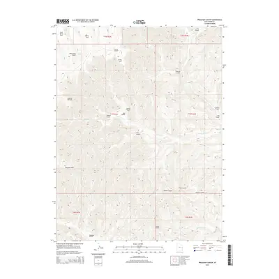
2014 Map of Preacher Canyon
USGS Topo · Published 2014About this map
Diamond Ridge Gas Field sits at the heart of this high-plateau landscape, illustrating the modern industrial footprint on the public lands of Grand County. The terrain is defined by a series of dramatic escarpments and canyon systems, including the namesake Preacher Canyon and the deeply incised Westwater Cr. To the north, Rock Spring Mesa and Cherry Mesa provide prominent topographic relief, while landmarks like Jumping Off Point and Westwater Point mark the sharp transitions between the mesas and the canyon floors below. The network of drainage systems is complex, featuring numerous named branches such as Sulphur Canyon, Rough Canyon, and Maverick Canyon. This survey captures the intersection of energy extraction and land management, with evidence of infrastructure like Pipeline Canyon and Well Hollow supporting the region's gas production facilities.
Find a feature on this map
28 named features on this map. Tap any name to fly to it.
Don’t see what you’re looking for? This feature index may not catch every label — zoom into the map to look around manually.
Map Details
Editions of this 2014 Preacher Canyon Map
This is the sole edition of this map. No revisions or reprints were ever made.
Other maps of this area

1885 · East Tavaputs
USGS Topo · 1:250,000

1956 · Grand Junction
USGS Topo · 1:250,000

1959 · Grand Junction
USGS Topo · 1:250,000

1960 · Grand Junction
USGS Topo · 1:250,000

1962 · Grand Junction
USGS Topo · 1:250,000

1963 · Tenmile Canyon
USGS Topo · 1:62,500

1963 · Sego Canyon
USGS Topo · 1:62,500

1964 · Grand Junction
USGS Topo · 1:250,000

1965 · Grand Junction
USGS Topo · 1:250,000

1970 · Flume Canyon
USGS Topo · 1:24,000