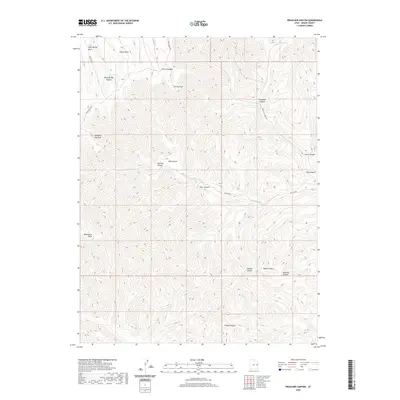
2020 Map of Preacher Canyon
USGS Topo · Published 2020About this map
Rock Spring Mesa and Cherry Mesa dominate the high-elevation landscape of this 2020 Grand County survey. The terrain is defined by a series of deep drainage systems, including Preacher Canyon and Sulphur Canyon, which reveal the erosive patterns of the Book Cliffs region. Movement through this high desert plateau is restricted to established ridgeline tracks such as Moon Ridge Rd and Book Cliff Ridge Rd. Important water sources and landmarks for navigation are indicated by labels like Rock Spring and the distinctive Jumping Off Point. The map provides a detailed record of the local geography as it stood in the early 21st century, showing the relationship between the elevated Westwater Point and the complex network of hollows and canyons like Well Hollow and Maverick Canyon that drain toward the south and east.
Find a feature on this map
23 named features on this map. Tap any name to fly to it.
Don’t see what you’re looking for? This feature index may not catch every label — zoom into the map to look around manually.
Map Details
Editions of this 2020 Preacher Canyon Map
This is the sole edition of this map. No revisions or reprints were ever made.
Other maps of this area

1885 · East Tavaputs
USGS Topo · 1:250,000

1956 · Grand Junction
USGS Topo · 1:250,000

1959 · Grand Junction
USGS Topo · 1:250,000

1960 · Grand Junction
USGS Topo · 1:250,000

1962 · Grand Junction
USGS Topo · 1:250,000

1963 · Tenmile Canyon
USGS Topo · 1:62,500

1963 · Sego Canyon
USGS Topo · 1:62,500

1964 · Grand Junction
USGS Topo · 1:250,000

1965 · Grand Junction
USGS Topo · 1:250,000

1970 · Flume Canyon
USGS Topo · 1:24,000