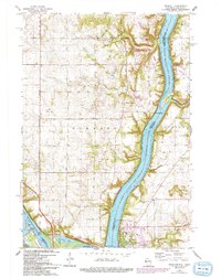
1967 Map of Prescott
USGS Topo · Published 1993About this map
Lake St Croix and the Mississippi River converge at this major river junction, where the historic town of Prescott overlooks the waters from its position in Wisconsin. The map captures a landscape defined by its riparian geometry, featuring the Kinnickinnic Sandbar and Elevator Bay along the eastern shore. Across the water in Minnesota, the small settlement of Point Douglas sits at the tip of the peninsula.
Find a feature on this map
40 named features on this map. Tap any name to fly to it.
Don’t see what you’re looking for? This feature index may not catch every label — zoom into the map to look around manually.
Map Details
Editions of this 1967 Prescott Map
4 editions found
Other maps of this area

1944 · Red Wing
USGS Topo · 1:62,500

1946 · Hudson
USGS Topo · 1:62,500

1946 · River Falls
USGS Topo · 1:62,500

1949 · River Falls
USGS Topo · 1:62,500

1949 · Hudson
USGS Topo · 1:62,500

1949 · Lake Elmo
USGS Topo · 1:24,000

1949 · Hudson
USGS Topo · 1:24,000

1950 · Lake Elmo
USGS Topo · 1:24,000

1950 · Hudson
USGS Topo · 1:24,000

1950 · St Paul Park
USGS Topo · 1:24,000