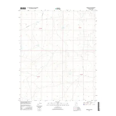
2017 Map of Presler Lake
USGS Topo · Published 2017About this map
Presler Lake sits within the high plains of Chaves County, anchoring a landscape defined by seasonal water sources and ranching infrastructure. This 2017 survey details a remote pocket of New Mexico where the Long Arroyo drainage cuts across township lines including t8s r29e and t9s r30e. The distribution of features like Broke Tank, Cooper Tank, and the larger Broke Tank Lake highlights the critical role of water management in this arid environment. Transportation through these sections is sparse, relying on local connectors such as White Lake Ranch Rd and the aptly named Bad Rd. Other notable depressions and water bodies including Lost Lake and Red Lake provide markers for navigating the open country north of Cato Rd.
Find a feature on this map
15 named features on this map. Tap any name to fly to it.
Don’t see what you’re looking for? This feature index may not catch every label — zoom into the map to look around manually.
Map Details
Editions of this 2017 Presler Lake Map
This is the sole edition of this map. No revisions or reprints were ever made.
Other maps of this area

1949 · Sardine Mountain
USGS Topo · 1:24,000

1954 · Brownfield
USGS Topo · 1:250,000

1955 · Roswell
USGS Topo · 1:250,000

1958 · Brownfield
USGS Topo · 1:250,000

1958 · Roswell
USGS Topo · 1:250,000

1962 · Roswell
USGS Topo · 1:250,000

1962 · Brownfield
USGS Topo · 1:250,000

1967 · Elkins
USGS Topo · 1:24,000
1967 · Sardine Lake
USGS Topo · 1:24,000
1973 · Oasis
USGS Topo · 1:24,000