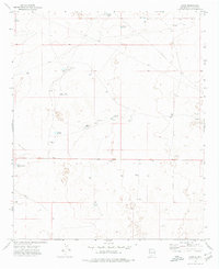
1973 Map of Oasis
USGS Topo · Published 1976About this map
Oasis serves as a central point in this Chaves County landscape, where the distribution of water resources dictated the pattern of early 1970s ranching and land use. The map identifies several family-named homesteads and operations, including Isler Ranch, Glenn Ranch, and Sand Ranch, which are connected by a network of unimproved roads and a Jeep Trail. Given the arid climate of this New Mexico region, the high density of catchment basins like Westfall Tanks, Claypit Tanks, and Crump Tanks highlights the critical infrastructure required for livestock management.
Find a feature on this map
22 named features on this map. Tap any name to fly to it.
Don’t see what you’re looking for? This feature index may not catch every label — zoom into the map to look around manually.
Map Details
Editions of this 1973 Oasis Map
2 editions found
Other maps of this area

1949 · Sardine Mountain
USGS Topo · 1:24,000

1949 · Malstrom Ranch
USGS Topo · 1:24,000

1954 · Brownfield
USGS Topo · 1:250,000

1955 · Roswell
USGS Topo · 1:250,000

1958 · Brownfield
USGS Topo · 1:250,000

1958 · Roswell
USGS Topo · 1:250,000

1962 · Roswell
USGS Topo · 1:250,000

1962 · Brownfield
USGS Topo · 1:250,000
1967 · Sardine Lake
USGS Topo · 1:24,000

1973 · Culp Ranch
USGS Topo · 1:24,000