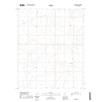
2020 Map of Presler Lake
USGS Topo · Published 2020About this map
Presler Lake and the drainage of Long Arroyo define this high plains landscape in eastern Chaves County. This 2020 survey documents a region defined by scattered water catchments and ranching infrastructure, where life revolves around isolated features like Broke Tank Lake, Cooper Tank, and Broke Tank. The map shows a transition from the drainage systems of the west toward the drier, higher elevations in the east.
Find a feature on this map
15 named features on this map. Tap any name to fly to it.
Don’t see what you’re looking for? This feature index may not catch every label — zoom into the map to look around manually.
Map Details
Editions of this 2020 Presler Lake Map
This is the sole edition of this map. No revisions or reprints were ever made.
Other maps of this area

1949 · Sardine Mountain
USGS Topo · 1:24,000

1954 · Brownfield
USGS Topo · 1:250,000

1955 · Roswell
USGS Topo · 1:250,000

1958 · Brownfield
USGS Topo · 1:250,000

1958 · Roswell
USGS Topo · 1:250,000

1962 · Roswell
USGS Topo · 1:250,000

1962 · Brownfield
USGS Topo · 1:250,000

1967 · Elkins
USGS Topo · 1:24,000
1967 · Sardine Lake
USGS Topo · 1:24,000
1973 · Oasis
USGS Topo · 1:24,000